A formidable El Niño event, one of the strongest in the past 50 years, is expected to significantly alter New Zealand’s weather this winter. Meteorologists from Earth Sciences New Zealand predict that this event will influence weather patterns across the country starting this season.
Key facts:
- There is a greater than 60% probability that the El Niño event will be classified as ‘strong’ by spring.
- El Niño events often result in south-westerly winds over New Zealand, leading to increased rainfall in the south and west.
- This winter could bring dry conditions in the north and east while wetter conditions are likely in the west.
Jon Tunster, a meteorologist with Earth Sciences New Zealand, noted, “La Niña has only just ended, but there are indications that we’ll see a rapid flip to El Niño.” He added, “Given the projected strength of this event, it will be very surprising if New Zealand doesn’t feel some impacts.”
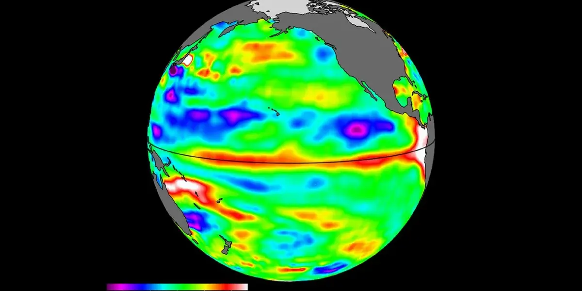
The Relative Oceanic Niño Index (RONI), which tracks ENSO conditions, is already showing a rapid rise consistent with the onset of El Niño. Warm sub-surface waters in the tropical Pacific Ocean are key indicators of significant El Niño events.
Daniel Kingston also emphasized that “put simply, El Niño is often associated with large-scale releases of heat from the tropical Pacific Ocean.” He warned that if projections hold true, “the impacts may be substantial.”
While officials expect notable changes in weather patterns, they acknowledge uncertainties remain. The exact strength of this El Niño event will become clearer in the coming months.